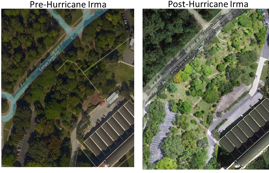
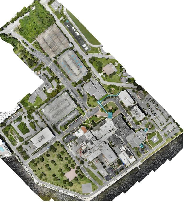
Our state of the art Mapping Technology allows for high-resolution 3D maps to be created. These maps can be used for a variety of scenarios such as navigation, construction and landscape planning, aerial topography and vegetation assessment, and more. As a low-cost and rapid deployment scenario, maps may be perfect for monitoring your next target location!
Unlike traditional imagery, these maps can be interacted with and explored on a three-dimensional level. This allows for a more complete and accurate picture of the area, without compromising the serenity of the location below.